
Rediscovering Japan

Rediscovering Japan
Travel (Wakkanai/Rishiri/Rebun (Hokkaido) Part 3 (Rebun)

by tomizuta
back to Wakkanai/Rishiri/Rebun Part 1
back to Wakkanai/Rishiri/Rebun Part 2
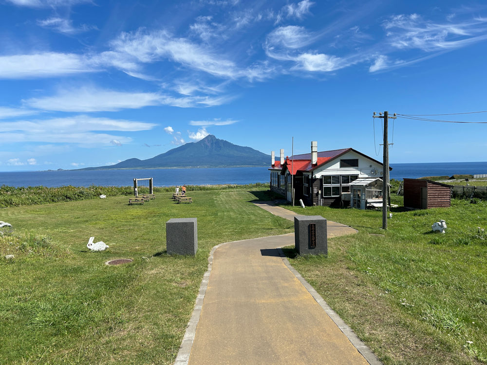
View of Rishiri Island and Mt. Rishiri (Rishiri Fuji) from the Kita-no Canaria Park at the southern tip of Rebun Island. Because of the magnificence of the view, this site was chosen as the location for the school in the film Kita-no Canaria-tachi ( English title: A Chorus of Angels), released in November 2012, and it has since been preserved and opened to the public as it was.
We took the ferry from Rishiri Island to Rebun Island. The sailing distance from Oshidomari Port in Rishiri to Kafuka Port in Rebun is just under 20 kilometers—a mere 45-minute journey. We had reserved first-class lounge seats, but soon found little justification for the higher fare. The ferry was nearly empty, and the so-called first-class lounge offered no particularly better view. At Kafuka Port, the driver of the sightseeing taxi we had booked was waiting for us with a sign in hand.
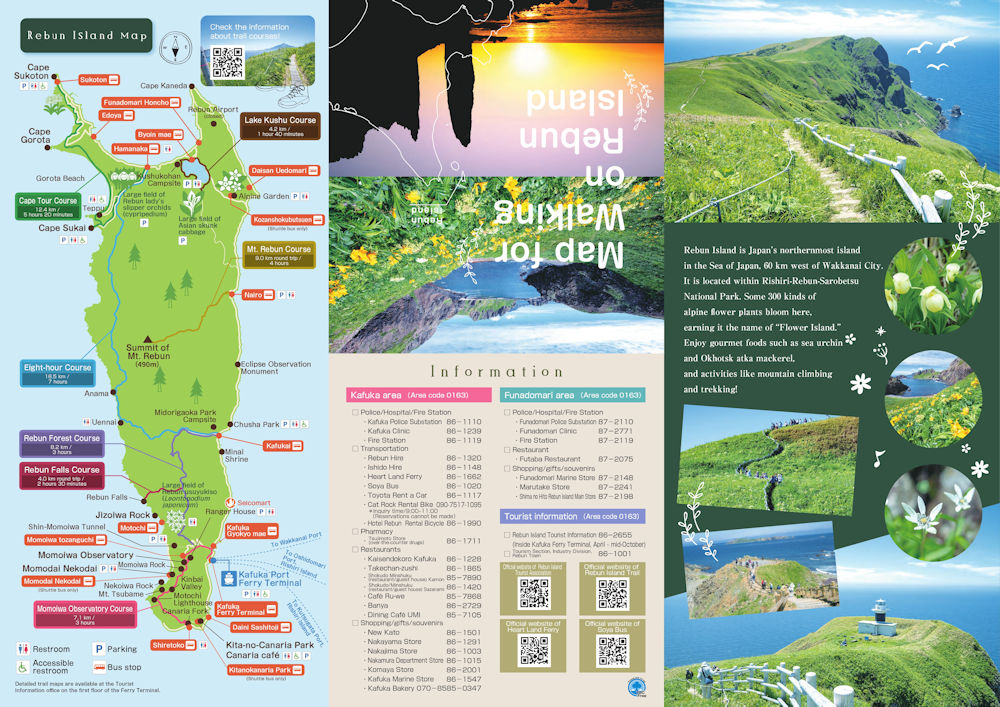
To help you understand how we traveled around Rebun, I’ve uploaded an English map. It is available on this website). We arrived by ferry at Kafuka Port, located on the east coast close to the bottom of the island. We first went south to visit the Kita-no Canaria Park at the southern tip. Following this, we went right up to the nort western tip, Cape Sukoton.
We had arranged a sightseeing taxi for three hours at a cost of 30,000 yen, and our driver turned out to be both friendly and well-informed. As part of our preparation for the Rishiri–Rebun trip, we had watched A Chorus of Angels (Kita no Kanariatachi), a film set largely on Rebun Island. The school used as a filming location has been preserved as “Kita no Canaria Park,” so we told the driver that apart from including a stop there, we would leave the rest of the course up to him. He first took us to Kita no Canaria Park, about three kilometers south of Kafuka Port, at the island’s southernmost tip. The film tells the story of a teacher, played by the famous actress Sayuri Yoshinaga, her six pupils at a remote island elementary school, and their lives twenty years later. One reason this site was chosen for the school location was the magnificent view of Mt. Rishiri rising across the sea. Stepping into the school building, we were impressed by the attention to detail—even down to the desks and textbooks. In the classroom, visitors are greeted by a virtual Sayuri Yoshinaga, a whimsical touch that adds to the experience.
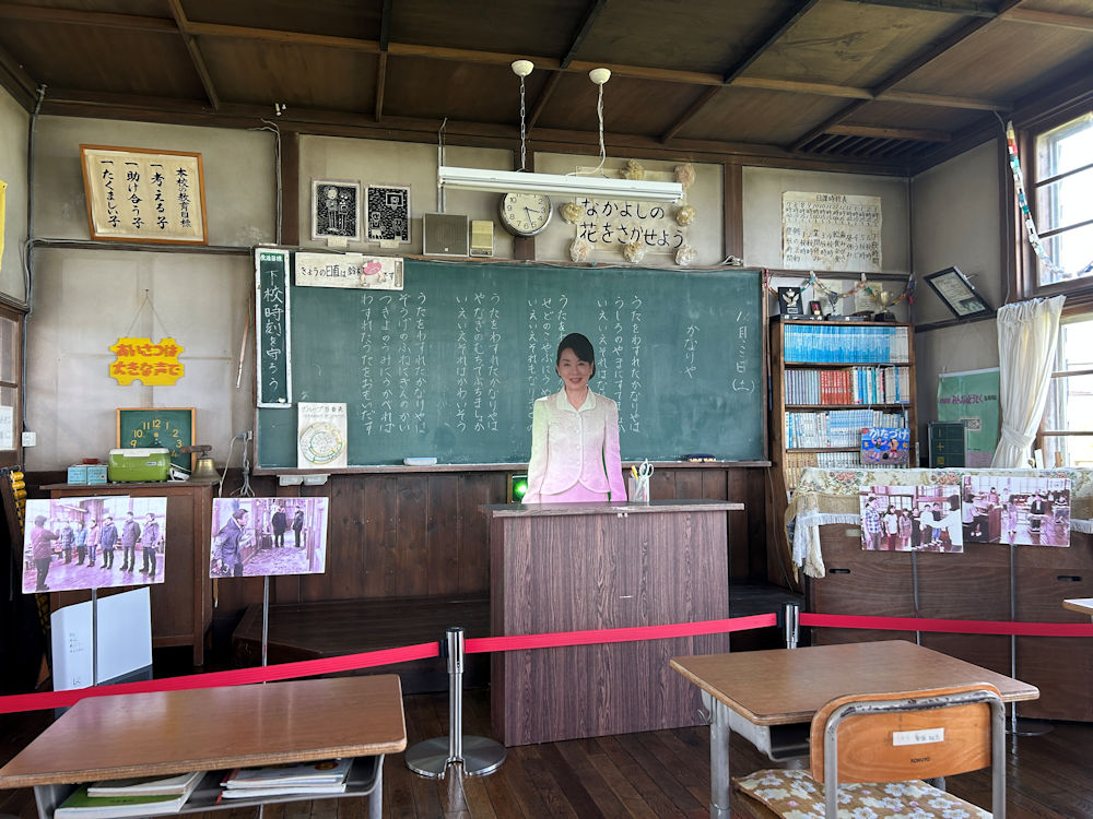
Stepping into the school building, we were impressed by the attention to detail—even down to the desks and textbooks. In the classroom, visitors are greeted by a virtual Sayuri Yoshinaga, a whimsical touch that adds to the experience.
The driver’s next destination was Cape Sukoton at the northernmost tip of Rebun Island. Unlike Rishiri, Rebun has no road encircling the island. Its main arteries are Prefectural Route 40, which runs north–south along the island’s eastern coast from the southern Kanaria Park area to the northern settlement of Funadomari, and Prefectural Route 507, which branches east–west from Funadomari. Along the way, the driver shared various useful bits of information. The island has no hospital, only clinics located in Kafuka, where the ferry terminal is, and in Funadomari. Likewise, there are only two traffic lights on the island, one in each of those two towns. What’s more, the one in Funadomari is a push-button signal installed so that preschool children can learn how to use traffic lights and cross the street safely.
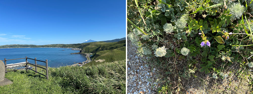
I thought the landscape of Rebun very much resembled that of Scotland. View of Funadomari Bay looking east with Mt. Rishiri in the back (left). Rebun Island is known as “the island of flowers” for its abundance of alpine blossoms. Rebun Island is known as “the island of flowers” for its abundance of alpine blossoms. The driver, who seemed quite knowledgeable, pointed out plants growing at our feet—Asagiriso (silvermound; the white flowers in the middle), Tsurigane ninjin (Adenophora triphylla var. japonica; the purple flowers), and Nokogiriso (alpine yarrow; in between).
The driver himself was not a native of the island. He comes to Rebun each year to work as a taxi driver during the May–September tourist season, and the hotel where we were staying also operates only in that period. By transferring his residency each time he arrives, he is treated as an islander and eligible for ferry discounts. He also mentioned that the local high school on Rebun recruits exchange students from across Japan. Taken together, these factors suggest that although the island has a population of just over 2,000, a fair number of outsiders come during the tourist season. “Since you’ve gone to the trouble of hiring a sightseeing taxi, let me take you somewhere the buses don’t go,” the driver said as he turned off the main road onto a narrow mountain path. There were no tall trees, only expanses of green grass, which gave the place a feel reminiscent of Scotland. He brought us to Todojima Observatory, a lookout perched on a hill about 100 meters high. Blessed with fine weather, we enjoyed sweeping panoramic views—not only of Cape Sukoton, but across Funadomari Bay all the way east to Cape Kaneda. The scenery was breathtaking.
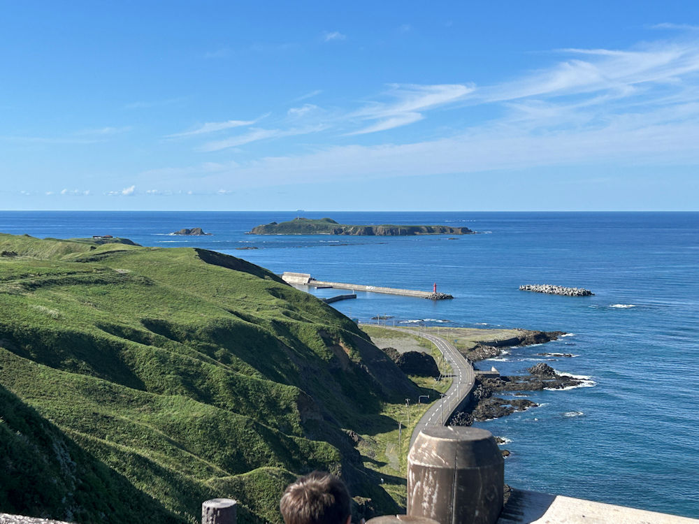
Blessed with fine weather, we enjoyed a great panoramic views of Cape Sukoton. The Island seen in the back is Todojima (Sea Lion Island).
From the Todojima Observatory, we descended to Cape Sukoton. Just as we arrived, a sightseeing bus pulled in, and the narrow tip of the cape was suddenly swarming with tourists—so crowded that we were astonished to see how many people came here.
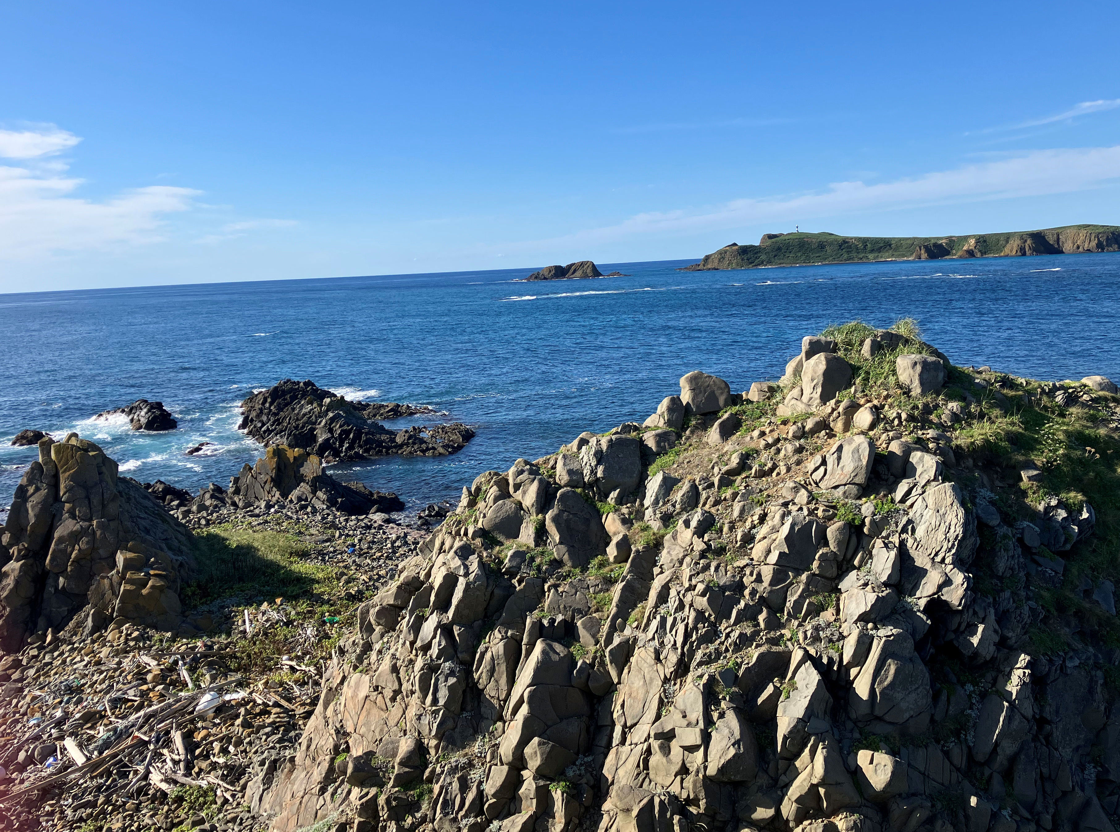
Looking north from Cape Sukoton. The island seen in the back is Todojima.
From Cape Sukoton we doubled back to Funadomari and then continued eastward to Cape Kaneda, which juts out into the sea. This cape is home to the Japan Ground Self-Defense Force’s Rebun detachment and the now-unused Rebun Airport. Scheduled flights between Rebun and Wakkanai were suspended in 2003 due to low passenger numbers. Officially the airport is not closed but merely inactive. Still, despite being maintained, it has a rather desolate air.
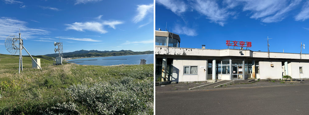
View of Funadomari Bay and Cape Sukoton from the Cape Kaneda side (left). The inactive Rebun Airport had a rather desolate air (right).
On the way back to our hotel in Kafuka, the driver noted we still had some time and turned off onto a small mountain road near the middle of the island. From the lookout he took us to, the view of Rishiri Fuji was, as he claimed, the finest on the island. I felt that for traveling around Rebun efficiently, a sightseeing taxi is indeed a highly effective option.
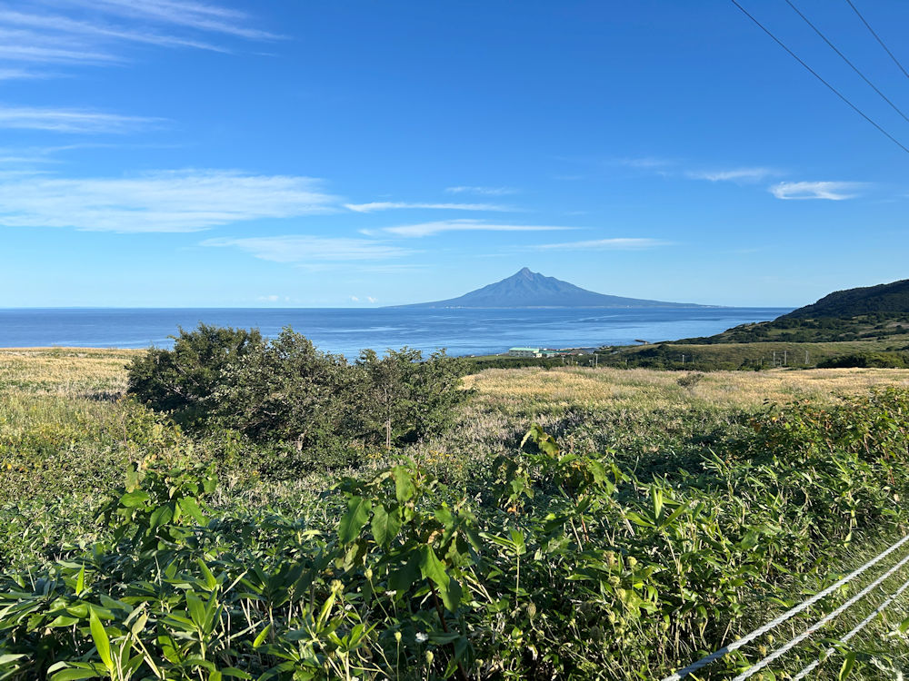
The view of Rishiri Fuji from the mountain road was the finest on the island according to our driver.
The following day we were scheduled to take the ferry back to Wakkanai, continue by train to Asahikawa, spend a night there, and then fly from Asahikawa Airport to Haneda. However, due to the heavy rains that had hit the Sōya region the previous day, train service on that section was suspended, forcing us to suddenly change our return plans. (Although service resumed about a week later, another spell of torrential rain a few days afterward led to a second suspension that lasted nearly two weeks.) Our options were either to fly directly from Wakkanai to Haneda, or to return to Rishiri Island, fly from Rishiri Airport to Okadama Airport in Sapporo, and then connect to Haneda from either Asahikawa or New Chitose Airport. We chose the once-daily flight from Rishiri to Okadama. The experience was a reminder of how important it is to keep the possibility of transport disruptions in mind when traveling to remote islands. Before boarding the ferry back to Rishiri the next day, we visited the Rebun Town Historical Museum, located not far from our hotel, which conveniently opens early at 8:30 a.m., even though it was raining.
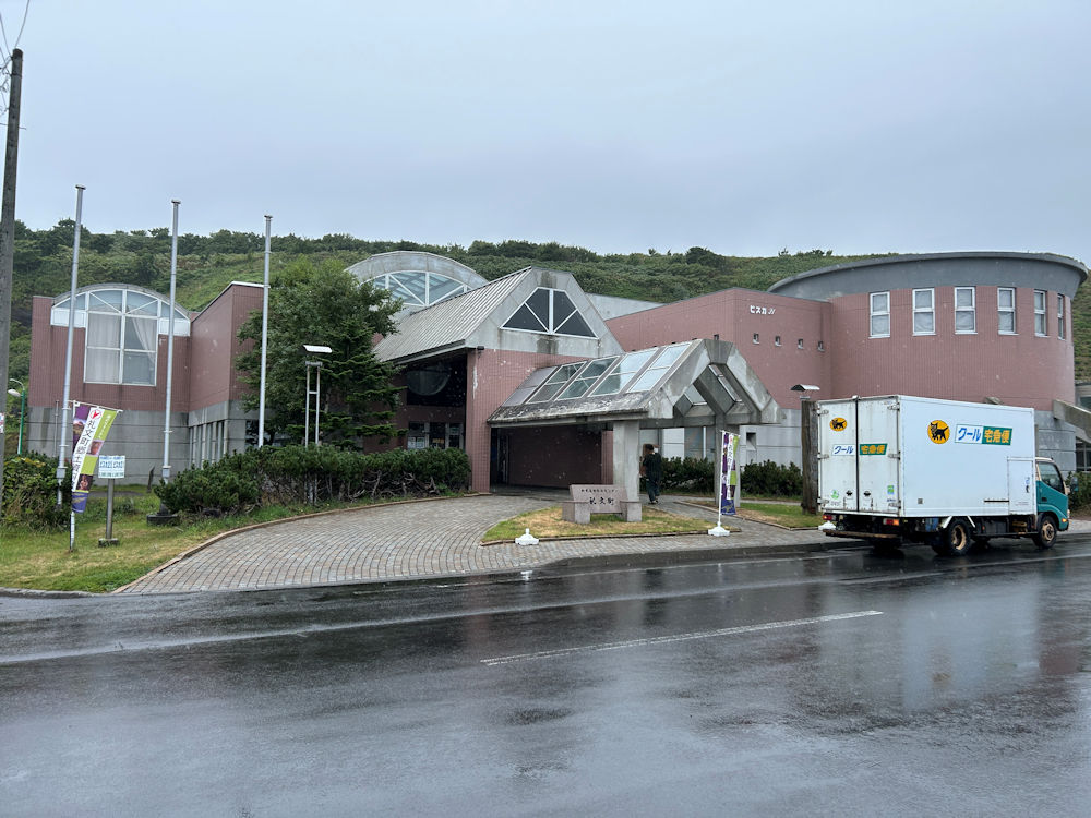
Before boarding the ferry back to Rishiri, we visited the Rebun Town Historical Museum located close to KaFuka Ferry Terminal.
The Historical Museum proved to be unexpectedly informative, and we spent a full hour viewing the exhibits. A considerable portion of the museum is devoted to the island’s archaeological history from prehistoric times. I had always imagined Jomon culture spreading gradually from central Japan to the Tohoku region and then on to Hokkaido, but I learned that this assumption was mistaken. That misconception had apparently stemmed from my knowledge of how wet rice cultivation spread progressively from Kyushu to Tohoku. On Rebun, however, remains from the Middle Jomon period, about 5,000 years ago, have been discovered in the Uedomari area between Funadomari and Kafuka, making it clear that people had already been living on the island at least since that time. Because rice cultivation was never introduced here, the Epi-Jomon period—based on hunting and fishing—lasted until around the 7th century. This culture then blended with the Okhotsk culture, which carried strong continental influences, and eventually gave way, as elsewhere in Hokkaido, to the Satsumon culture, which in turn evolved into Ainu culture. I felt I should study this subject further. Although our tour of Wakkanai, Rishiri, and Rebun had been rather hurried, it turned out to be a journey full of learning.
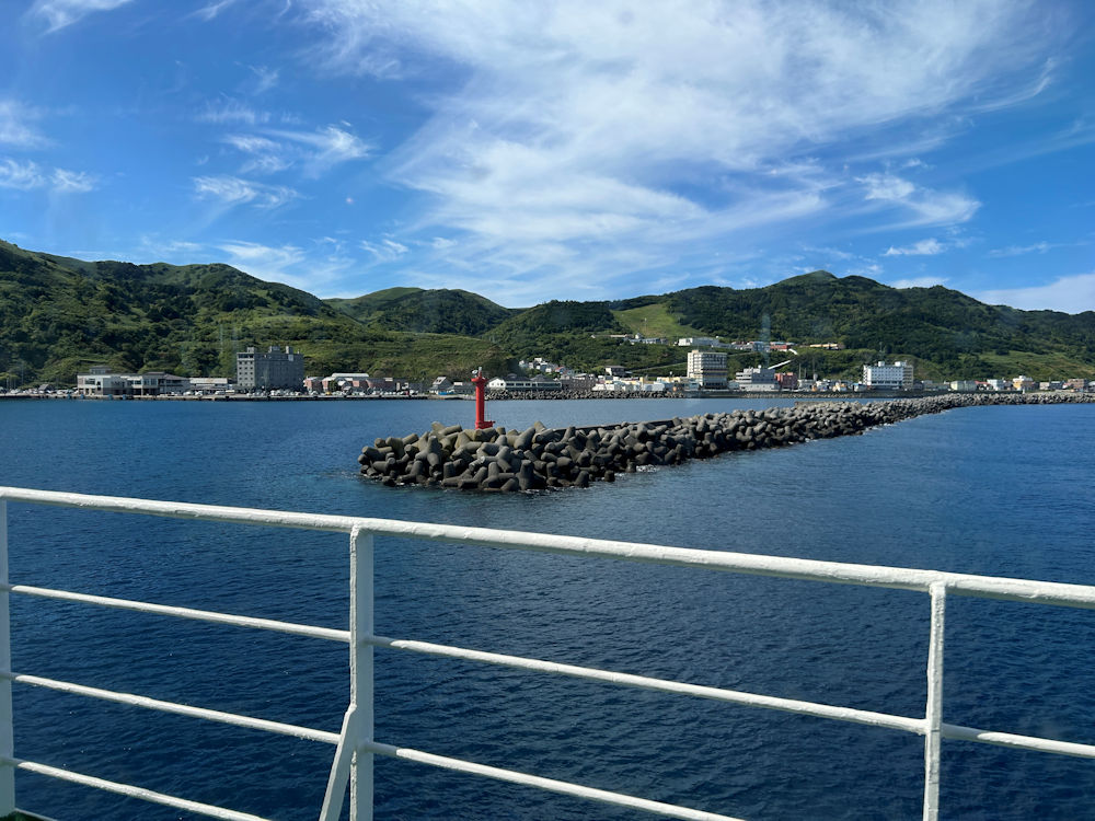
Due to the suspension of service on the JR Soya Main Line between Wakkanai and Asahikawa caused by heavy rain, we hastily changed our plans to return by air from Rishiri Airport and left Rebun Island on the ferry bound for Rishiri.