
Rediscovering Japan

Rediscovering Japan
Travel (Wakkanai/Rishiri/Rebun (Hokkaido) Part 1 (Wakkanai))

by tomizuta
continue to Wakkanai/Rishiri/Rebun Part 2
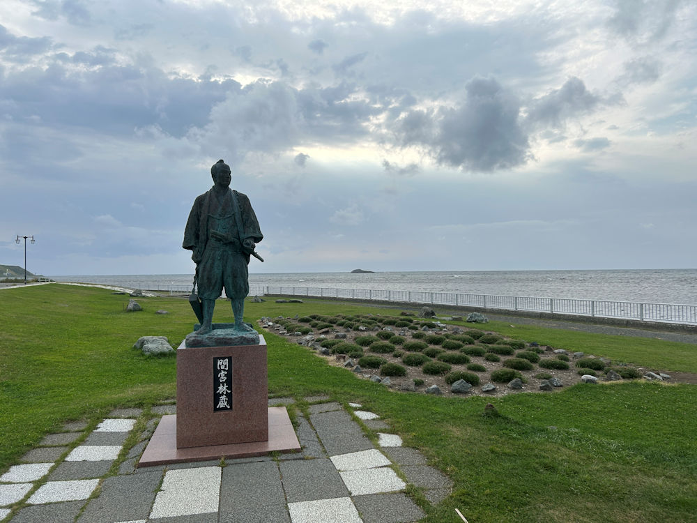
Statue of Rinzo Mamiya at Cape Soya, the northernmost point of Japan. He was a famous explorer of the late Edo era, best known for exploring Karafuto, now known as Sakhalin. He departed for Karafuto from Soya.
For the past ten years, we have been traveling around Japan each year with two other couples. We usually stay at the same inn and share breakfast and dinner, but otherwise explore separately, following our own interests. After visiting the Goto Islands in the fall of 2024, we set out in late August 2025, just after the Obon holidays, for Rishiri and Rebun Islands. Rishiri lies about 50 kilometers west of Wakkanai, the northernmost city of Hokkaido, while Rebun Island is just under 10 kilometers northwest of Rishiri. To reach Rishiri and Rebun from Tokyo, the usual routes are to fly via New Chitose or Okadama airports in Sapporo to Rishiri Airport, or take a ferry from Wakkanai. Since there are no direct flights from Haneda to Okadama, the quickest air route requires a transfer at New Chitose, but only one flight operates daily. To give ourselves more flexibility, we decided to stayed overnight in Wakkanai and then take the ferry to Rishiri.
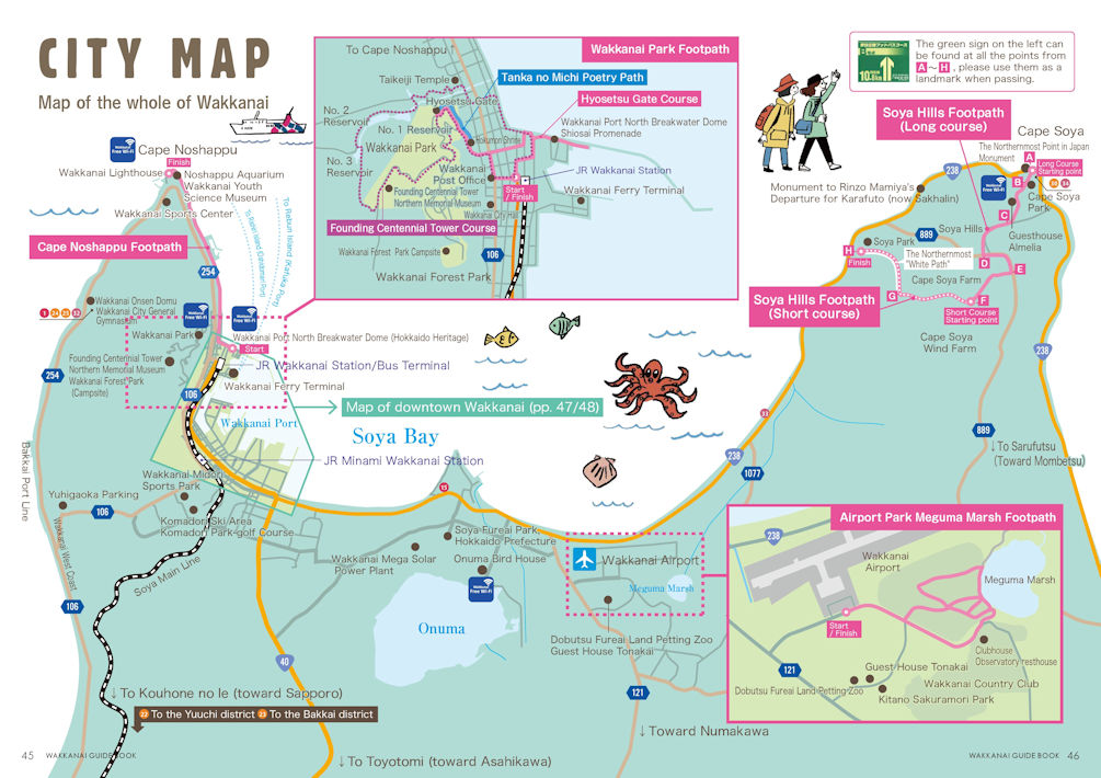
Above is a map to help understand the route I traveled. I aarived at Wakkanai Airport in the middle, drove north east along the coast to Cape Soya. I then went back westward on the same national road, went past the airport to arrive at the hotel in downtown Wakkanai. This maps is available on Wakkanai City's website.
Our flight from Haneda to Wakkanai, departing shortly after 1:00 p.m.,
was undergoing a weather check due to strong winds in the Wakkanai and
Rishiri area. Although we departed almost on schedule, there was a possibility
we might have to land at New Chitose or return to Haneda. From the very
beginning, it was clear that traveling to Rishiri and Rebun required careful
attention to the weather. We arrived at Wakkanai Airport with only a slight
delay. From there, we switched to a rental car and headed toward Cape Soya.
It is an easy drive along the coast via the national highway to Cape Soya,which
is about 25 kilometers northeast of the airport. Cape Soya, located at
nearly the northernmost tip of Japan, is just about 40 kilometers from
Russia’s Sakhalin Island. It was cloudy with occasional rain, so unfortunately
I couldn't make out Sakhalin. Despite the bad weather, the line of people
taking commemorative photos at the cape never seemed to end.
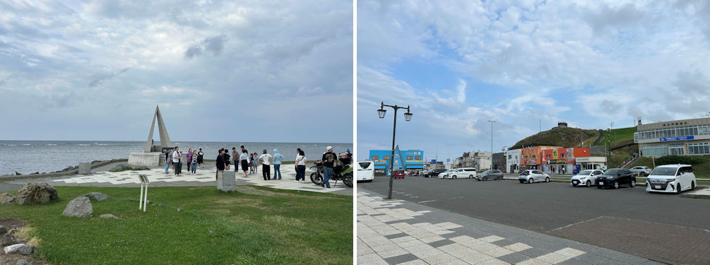
The line of people taking commemorative photos at the cape never seemed to end (left). There were many places to eat at Cape Soya (right).
I discovered that Soya has a much longer history than I had previously imagined. From the general knowledge I learned in school decades ago, Hokkaido’s development was said to have begun in earnest after the Meiji era, with booming herring fisheries and coal production that supplied fuel for steamships and raw material for ironmaking. I knew that during the Edo period, the Matsumae Domain was the only feudal domain established in Hokkaido, but beyond that, I had never been taught much detail. Through this trip, one of the great rewards was coming into contact with Hokkaido’s long history, stretching back even to prehistoric times. About seven kilometers back toward Wakkanai from Cape Soya lies the Soya Municipal Office. This was the site where, in 1688, the Matsumae Domain established a trading post—known as Soya Basho—under its administration to conduct trade with the Ainu. It remained the administrative center of the entire Soya region until the early Meiji period. However, with the advent of larger vessels and the spread of steamships in the Meiji era, the Soya coast, with its shallow waters and many reefs, was avoided. As a result, the regional hub shifted to what is now central Wakkanai. A signboard beside the Sōya Branch Office tells that this place is regarded as the birthplace of Wakkanai.
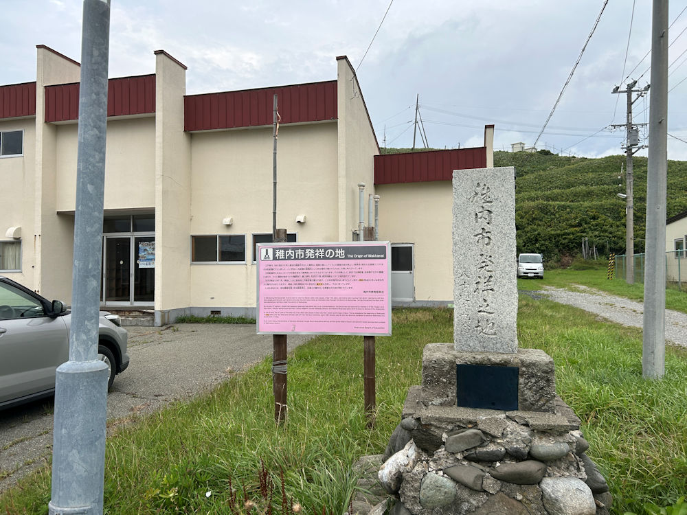
There was a monument telling that this was the area that Wakkanai City originated. Nowadays it has become a rather desolate area.
In the early 19th century, Russia sought trade with Japan, which was then under a policy of national seclusion, and launched raids along the coast of Hokkaido. In response, the Tokugawa shogunate made Soya shogunal land under its direct control and ordered several northeastern domains, beginning with Aizu, to send troops to guard Ezochi (as Hokkaido was then called). In 1808, as many as 587 samurai from the Aizu domain were dispatched to Soya, but the harsh winter conditions and cases of edema claimed many lives. Near the Soya Branch Office lies Soya Park, where the graves of these former samurai can be found. Just to the left of the cemetery are the remains of Soya Itsukushima Shrine and Soya Gokokuji Temple (the temple has since been rebuilt across from the park). Itsukushima Shrine was likely founded in the late 18th century to pray for safety at sea, just like the famous Itsukushima Shrine in Hiroshima. Gokokuji Temple, meanwhile, was one of the rare temples permitted to be established in the late Edo period, as part of efforts to protect Japan’s northern frontier.
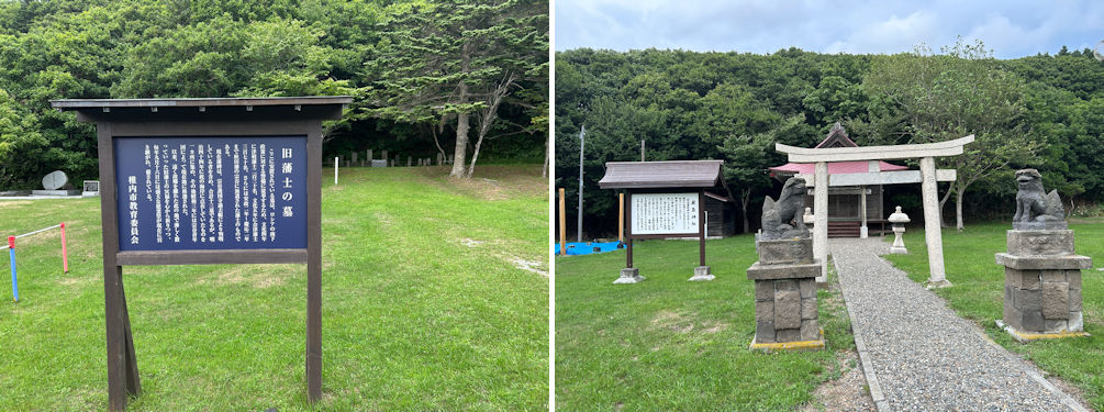
Signboard for the graves of former Aizu samurai (graves behind, left). Itsukushima Shrine, still an active place of worship (right).
As dusk was setting in, we left Soya Park, passed by Wakkanai Airport where our journey had begun, and entered the city center of Wakkanai. We checked into a hotel near Minami-Wakkanai Station that we had booked in advance. There is also a nightlife district around Minami-Wakkanai, but since it was still during the Obon holiday, many restaurants were closed. The markets were also shut for the season, so our dining options were limited. The restaurant we finally entered had no other customers besides us. Even so, it was there that I had my first taste of simmered hakkaku (Podothecus sachi), a local fish delicacy. Its name, which means “octagon” in Japanese, comes from the fish’s distinctive eight-sided body shape. Though its edible portions are limited, the flavor was exquisite.
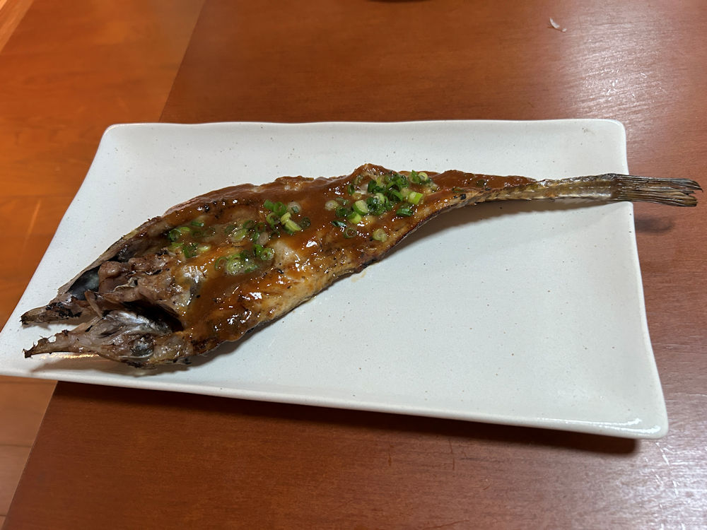
I had my first taste of simmered hakkaku (Podothecus sachi), a local fish delicacy. Its name, which means “octagon” in Japanese, comes from the fish’s distinctive eight-sided body shape. Though its edible portions are limited, the flavor was exquisite.
On the second day of our trip, we left our hotel early to visit Cape Noshappu, since we were scheduled to take a morning ferry to Rishiri Island. Cape Noshappu lies about five kilometers north of Wakkanai Station, much closer to the city center compared with Cape Soya. On a clear day, it is said you can see Rishiri and Rebun Islands from here, but unfortunately, the rain continued and there was no such view for us. At the tip of the cape, there is a small aquarium, along with a few parking spaces right in front of the Cape Noshappu signboard. After taking a few photographs, we returned our rental car in Wakkanai and headed to the ferry terminal by taxi.
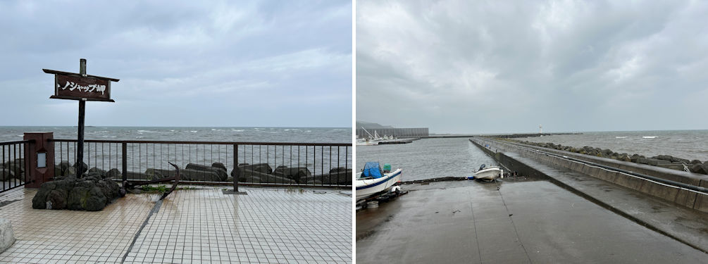
The Cape Noshappu signboard (left). The signboard lies next to a small fishing port where there are a couple of parking spaces (right).
The terminal has its ticket counters on the first floor and the boarding
area on the second. However, when we arrived, the ticket counters downstairs
were unmanned. Checking the arrival and departure monitor upstairs, we
saw that despite the bad weather, ferries were operating on schedule. So
we went back down to the unmanned counter area, where there was a ticket
machine, and bought tickets for the 11:15 Rishiri ferry. To our surprise,
the tickets had no departure time printed on them. With no staff at the
counter to ask, we were left a little uncertain. Over time, we’ve come
to understand how this system works: staff generally appear only shortly
before the ferry arrives, first to handle disembarking passengers, and
only then to take care of boarding passengers. The ferry we boarded had
arrived from Rebun at 10:50 a.m., and then turned around to depart for
Rishiri at 11:15. On the second floor of the terminal there is a waiting
area and a restaurant, but because the Obon holiday coincided with a Sunday,
the restaurant was closed. The waiting area itself was also rather quiet,
with only a handful of passengers waiting to board.
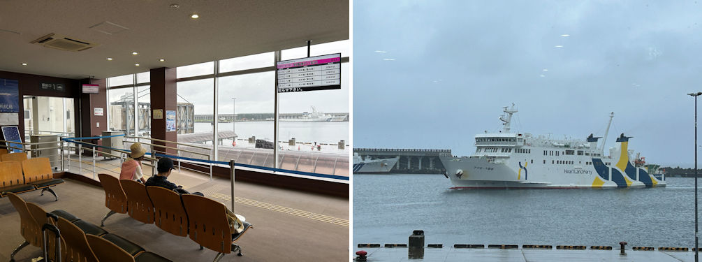
The waiting area on the second floor was quiet. The monitor showed that ferries were operating on schedule (left). The ferry from Rebun arriving on schedule (right).