
Rediscovering Japan

Rediscovering Japan
Travel (Wakkanai/Rishiri/Rebun (Hokkaido) Part 2 (Rishiri)

by tomizuta
continue to Wakkanai/Rishiri/Rebun Part 3
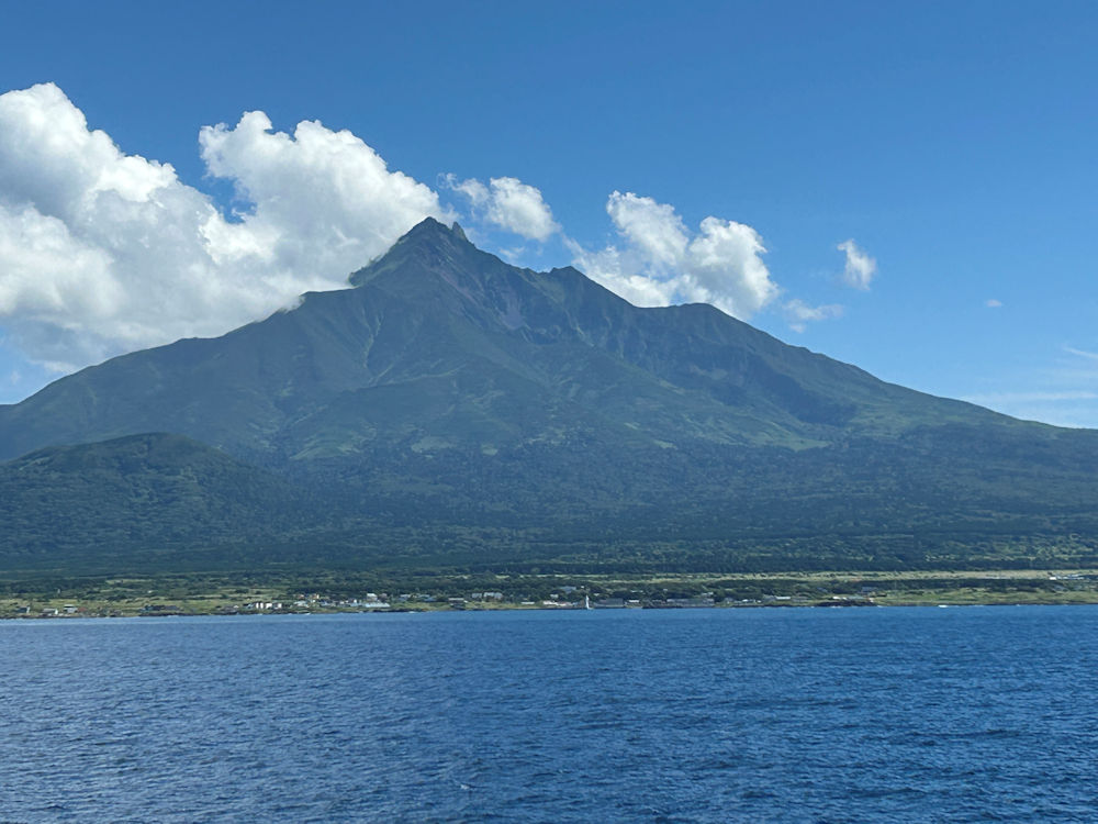
View of Rishiri Island and Mt. Rishiri (Rishiri Fuji) from the sea
The ferry to Rishiri Island departed on schedule and turned out to be far more luxurious than I had expected. Seating was mostly in chairs, and we chose unreserved seats by a window on the second floor. Perhaps because the busy Obon holidays had just ended or due to the poor weather, the number of passengers was quite sparse. Although the straight-line distance from Wakkanai to Rishiri Island is just over 40 kilometers, the ferry route first heads north from Wakkanai Port, circles around Cape Noshappu, and then proceeds southwest, making the total distance to Oshidomari Port a little over 50 kilometers. With a travel time of 1 hour and 50 minutes, the ferry moves at a leisurely pace of about 35 kilometers per hour (just under 20 knots). Despite the wind and rain, the crossing was smooth and comfortable with hardly any rolling. I stepped out onto the deck, but visibility was poor, and even as we neared land, there was no sign of Mount Rishiri.
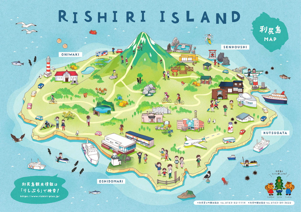
To help you understand how we traveled around Rishiri Island, I’ve uploaded a map (though it is inverted north-to-south, it was the only map of the entire island I could find in English. It is available on this website). We arrived by ferry at Oshidomari Port, located at the very bottom of the map (actually the island’s northernmost point), and then took the hotel’s shuttle bus to Kutsugata, shown on the right side of the map.
From Oshidomari Port, we took the hotel’s shuttle bus to our accommodation near Kutsugata Port in the southeast of the island, where we checked in. The rental car we had arranged was handed over at the hotel. At 7,000 yen for three hours, it was reasonably priced, though it was a light passenger car (kei car) without even a navigation system. Still, it was more than sufficient for touring an island with a circumference of just 60 kilometers. Since we had planned to join the sightseeing bus that runs twice daily the following day, we decided to visit places not covered by the bus route. Our first stop was the Rishiri Historical Museum, located in the Oniwaki district, nearly halfway around the island from
Kutsugata. The museum offered much to learn, and we spent over an hour
there. What struck me most was the history of Oniwaki. Today, Rishiri Island’s
population is around 4,000, but in the 1950s, at the height of the herring
fishery, it reached 11,000. Of those, 5,000 lived in the then Oniwaki Village,
which flourished with seasonal workers from all over Japan. The herring
fishery declined after the 1950s, and now it is hard to imagine the prosperity
of those days from the present streetscape. However, the museum itself
is housed in the former Oniwaki Village Office, built in 1913, which was
considered quite modern for its time. Another fascinating new discovery
for me was the story of Ranald MacDonald, an American who, in 1848 during
Japan’s period of seclusion, secretly landed on Rishiri Island from a whaling
ship. He was captured and sent to Nagasaki, but before being handed over
there to an American warship six months later, he taught English to fourteen
Dutch-language interpreters, becoming Japan’s first native English teacher.
One of the interpreters he taught went on to serve as an interpreter when
Commodore Perry’s fleet arrived a few years later.
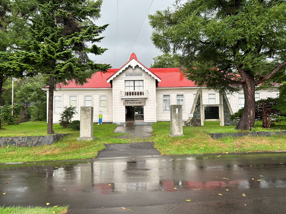
The charming Rishiri Historical Museum is housed in a historical building repurposed from the former Oniwaki Village Office building constructed in 1913, well worth spending some time to browse.
In the pouring rain, we retraced our route back toward Kutsugata, where we had started out. Rishiri Island is a volcanic island, formed by ancient lava flows from Mount Rishiri, which rises in the center of the island. For that reason, the coastline features many oddly shaped rocks created by lava flows. Just before reaching Kutsugata, we stopped at one such rock formation, Nekuma-iwa (“Sleeping Bear Rock”), so named because it resembles a bear lying down. There is no parking lot, but at this spot the road widens slightly, so we pulled over at the roadside to take a look. As a landmark, there is a bright vermilion shrine called Benten-kyu. Built relatively recently in 1969 on the basis of a dragon-god legend, it has now become a popular spot for viewing the sunset. Next to it stands a signboard for Nekuma-iwa, from which you can look down and see the rock below. It indeed resembles the shape of a bear. It is a scenic spot well worth a visit.
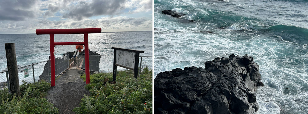
The Benten-kyu (left) and Nekuma-iwa (right) I hope you can make out the bear-like head at the tip of the rock.
Located slightly before Nekuma-iwa is the Rishiri Town Museum, which we took the opportunity to visit. Compared with the History Museum, this museum places more focus on the flora, fauna, insects, and daily life of the people of Rishiri. Those with an interest in these areas would likely find it engaging. The entire exhibition can be viewed in about thirty minutes. At both the Local History Museum and the Town Museum, however, there are hardly any pamphlets or exhibit descriptions available in English.
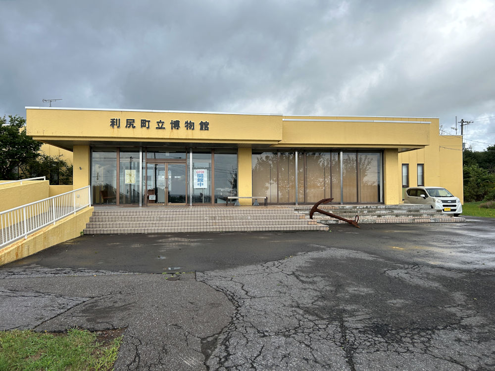
The Rishiri Town Museum, not far from the Kutsugata area.
Our final destination was the Hondomari district, located in the northeastern part of Rishiri Island between Oshidomari Port, where we had arrived by ferry, and Kutsugata. Rishiri first appeared in Japanese historical records in the mid-17th century. From that time, trade ships of the Matsumae clan began visiting the island, initiating contact with the indigenous Ainu. In the mid-18th century, a trading post known as an unjoya was established here in Hontomari as a base for Matsumae clan trade. This was nearly eighty years after a similar Ainu trading post, the Soya-basho, had been set up in Soya in 1688. Unjoya facilities were established in various parts of Hokkaido, but today the only surviving example is in Yoichi, a town now better known for its whisky near Otaru. At Hondomari, only a signboard marks the former site of the unjoya. By this time the wind had died down and the sun began to break through, reminding us how dramatically island weather can shift within a single day. Although we had only a three-hour rental car, we managed to cover nearly half of the island’s encircling road, making it a rewarding drive for gaining an overall sense of Rishiri.
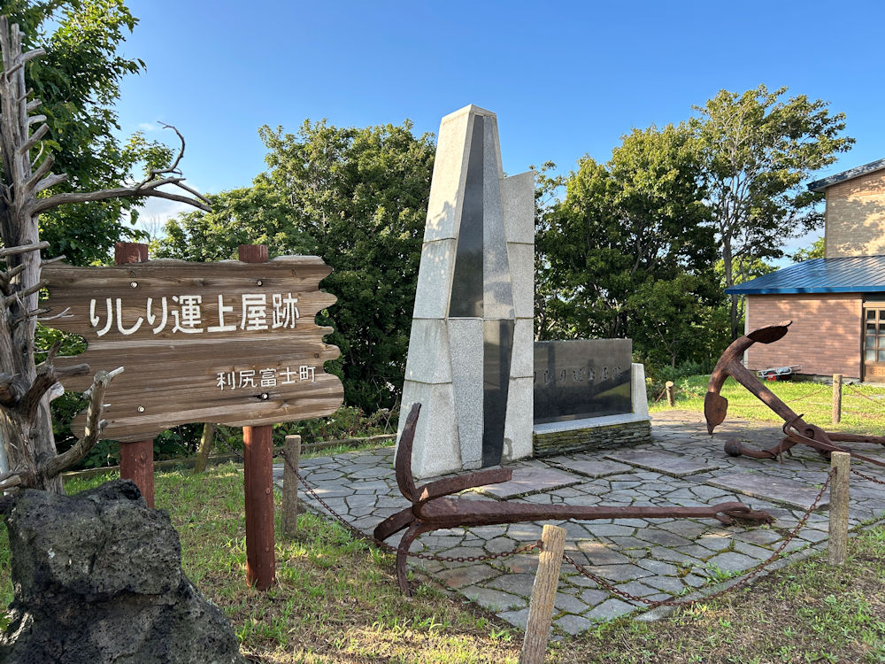
At Hondomari, only a signboard marks the former site of the unjoya, the trading post with the Ainu people in the Edo era.
It was bright and clear on the third day of our journey. On this day, we were to take the 13:15 ferry from Oshidomari Port to Rebun Island, continuing on from our hotel in Kutsugata. To make the most of the morning, we boarded the 8:25 sightseeing bus operated by the local bus company. This tour bus ran from Kutsugata to the ferry terminal at Oshidomari, then set out from Oshidomari Port on a clockwise circuit of the island, finishing back at the same terminal—a route perfectly suited to our plans. Including passengers who had boarded earlier at Oshidomari, the bus carried just under twenty people, roughly half its capacity. Our first stop was Himenuma, an artificial pond located only a short distance from Oshidomari, though a modest climb of 130 meters up the hillside. Surrounded by primeval forest, it is famed as a scenic spot where the reflection of Mt. Rishiri (Rishiri Fuji) can be seen mirrored in its waters. A walking path encircles the pond, and together with the rest of our tour group, we strolled the 800-meter trail in about fifteen minutes. The plantings, including mountain hydrangea, bore a striking resemblance to those found around the Yatsugatake highlands.
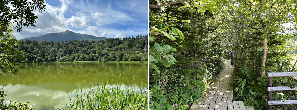
Surrounded by primeval forest, it is famed as a scenic spot where the reflection of Mt. Rishiri (Rishiri Fuji) can be seen mirrored in its waters (left). The plantings, including mountain hydrangea, bore a striking resemblance to those found around the Yatsugatake highlands (right).
The bus continued south along the island’s eastern coast, passing through the Oniwaki district—where we had visited the local history museum the previous day—before arriving at Otatomari Pond in the island’s southeast. This was our second stop. Unlike the man-made Himenuma, Otatomari Pond is a natural body of water, formed when a volcanic crater filled with water, and it is the largest pond on the island. Nestled within a vast marshland, it is known for its striking clusters of kakitsubata (Japanese iris) that bloom in June and July.
The pond is about one kilometer in circumference, and a walking path encircles it, but with only limited time at our disposal, we decided against a circuit and instead visited the nearby food stalls and souvenir shops. While the eateries advertised lavish sea urchin bowls priced in the thousands of yen, we opted for a simpler, more reasonably priced treat—grilled scallops, freshly cooked on the barbecue. Highly recommended.
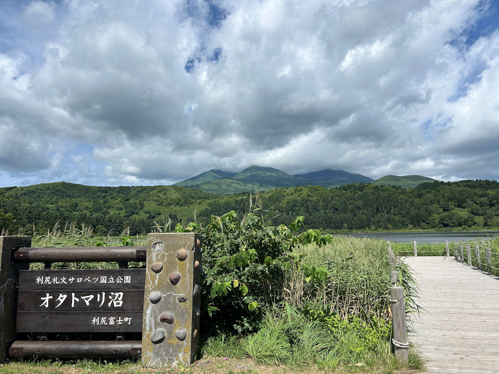
Unlike the man-made Himenuma, Otatomari Pond is a natural body of water, formed when a volcanic crater filled with water, and it is the largest pond on the island.
The next stop on our bus tour was Senposhi Misaki Park, located at the
island’s southernmost tip, not far from Otatomari Pond. Despite the name
“park,” its main attraction seemed to be the three shops selling Rishiri
kombu, the island’s famous kelp. We purchased some at one of them, and
indeed, it proved to be better value than what we later saw in souvenir
shops. From there, the bus continued on, dropping passengers at Kutsugata—where
we had boarded—and at Rishiri Airport, before finally arriving at the Oshidomari
ferry terminal. In just about three and a half hours, the sightseeing bus
provided a complete circuit of the island. Combined with our driving excursion
the previous day, we felt we had truly covered Rishiri in its entirety.
For the record, the bus fare was 3,500 yen.
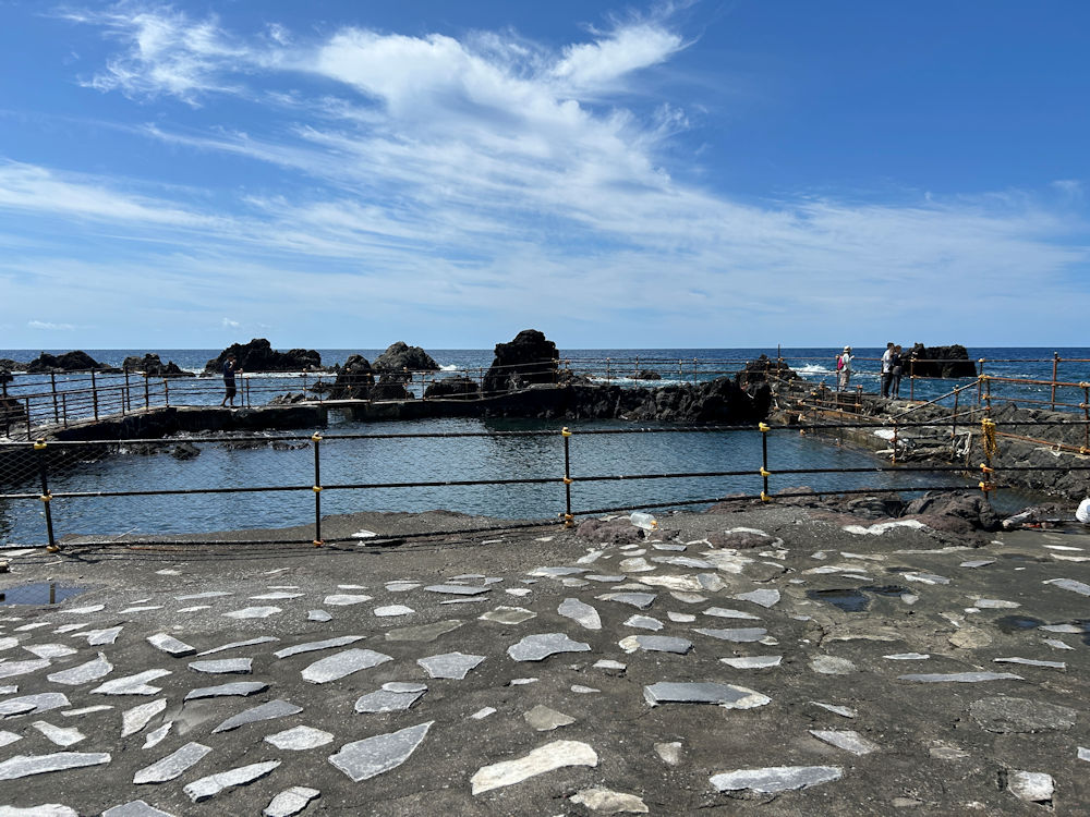
At Senposhi Misaki Park, our bus guide recommended we visit a fukuroma—a coastal facility once used to hold live herring temporarily. In the past, there were more than thirty of these structures on the island, but today only three remain, including this one.